Tuesday, September 28, 2010

GRAND BANK, NEWFOUNDLAND - FIRST WEEK OF AUGUST 2010

*** You may click on all photos to enlarge to full screen size. ***
*** Previous posts are on earlier pages (Link is at bottom of page). ***

Welcome to Grand Bank, Newfoundland.


Grand Bank is a commercial harbor that was once a hub of activity (all related to the fishery). The large trawler in the photo once belonged to Clearwater Fisheries. Apparently, the vessel was in a storm in shallow waters (either on the "banks" or inshore), and a huge wave came over the bow and blew out out some of the windows in the pilot house. The pilot house was flooded and all the electronics ruined. Of course everything is controlled by electronics on these large vessels so it was incapacitated and had to be towed in. It is currently awaiting sale. Can you imagine being in conditions with waves high enough to reach the bridge of this vessel?


We arrived just in time to enjoy the "Grand Band Day" festivities. Despite the rain, there were dory races for all age groups and sexes.


Mickey & Minnie even arrived to entertain the children.


Before the dory races, the locals warned us to put out fenders in order to protect our boat when the women raced. It was great entertainment, however, the only collision involved the fish plant wharf.


The contenders in the finals:


1941 Fargo fire truck:


The town of Grand Bank, as seen from the hill behind it:


Looking inland one realizes that all civilization is concentrated in towns along the shore.
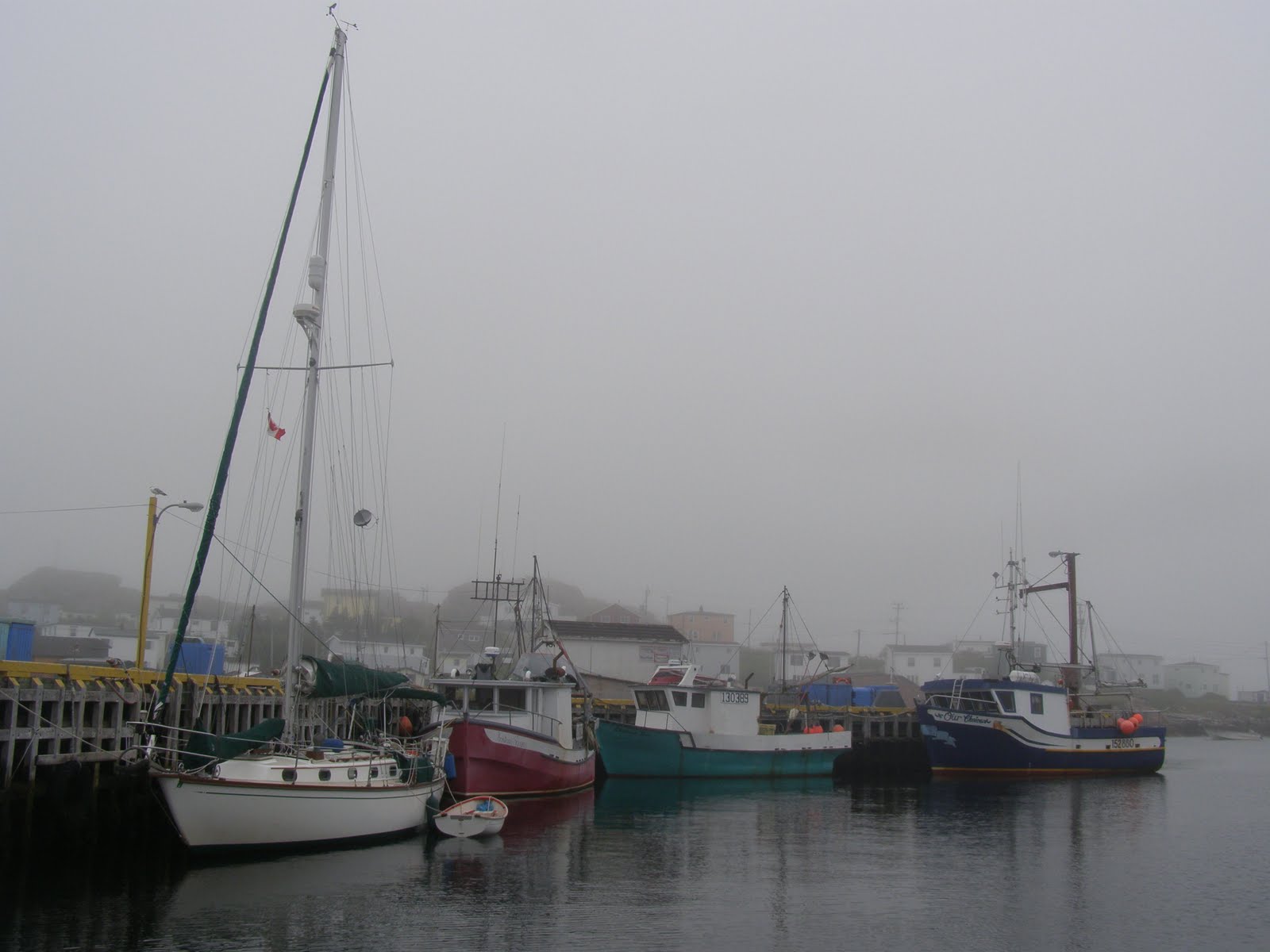
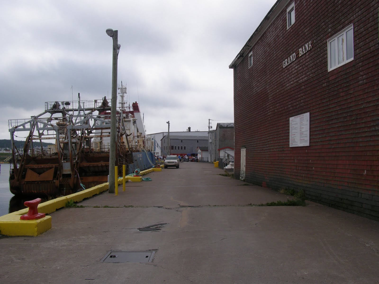


Grand Bank harbor:


Newfoundland lawn service:


The lure of the sea, or is it .... of the captain?


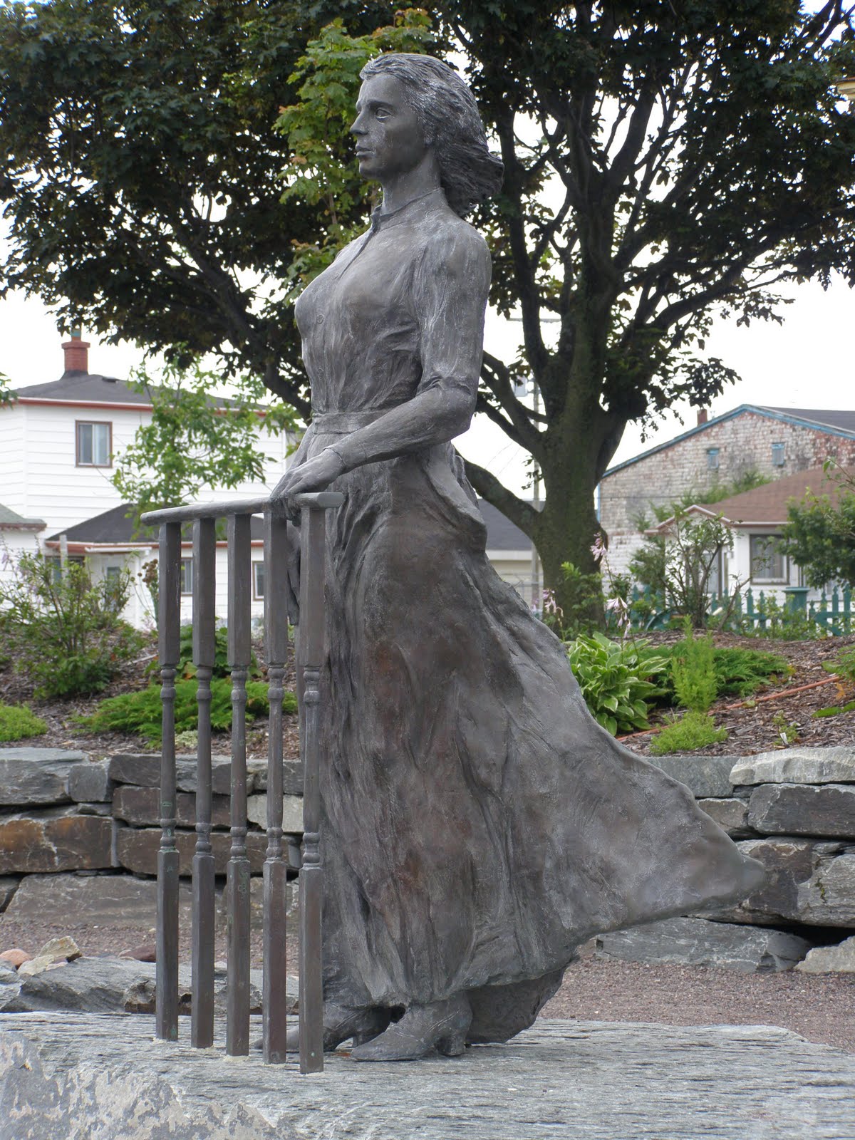
Waiting for her sailor to come home:


Dories are now powered by outboards. This fellow is going out to get his five cod that are allowed by the "food fishery" regulations.


Kerry Deare moving on:


Old wharehouse door, on the wharf:


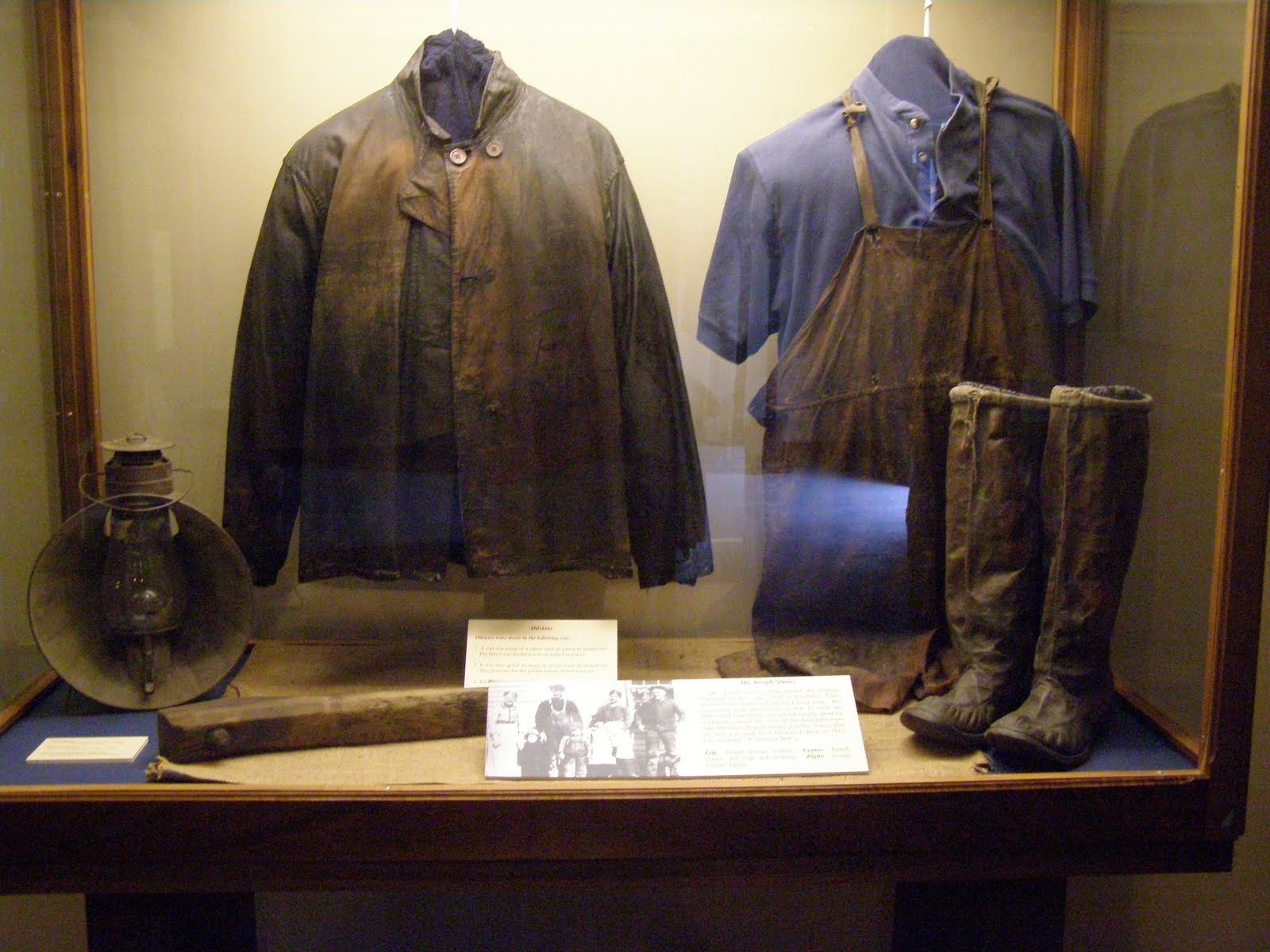
Big lines for a big job:


The glow of a bright new day at Grand Bank. Only three other sailboats came in while we were there.


The harbormaster said that when he was a child you could walk across the harbor on the decks of fishing schooners. It must have been a sight.


Today we turn, and head back towards the West, along the Southwest coast of Newfoundland.

THE FJORD COAST, NEWFOUNDLAND - AUGUST 3RD, 2010

*** You may click on all photos to enlarge to full screen size. ***
*** Previous posts are on earlier pages (Link is at bottom of page). ***

Once again it is time to move on. We have decided to make the 80nm jump to Grand Bank, where we will rendezvous with Kerry Deare, and then slowly work our way back along the Southwest coast of Newfoundland.

Today we passed offshore of a stretch called the Fjord Coast of Southwestern Newfoundland. Many of the fjords are miles long and have very narrow inlets.


This is the entrance of the Grey River Fjord. It's inlet is measured in feet and it is said that the GPS chartplotter can be up to .5nm off. To add to the fun there are strong tidal currents at the entrance which can cause rough seas in a wind vs. current situation.


Can you see it yet? Barely. The entrance is offset in order to make it interesting. Not a place to be in the fog.


Moving East along the coast:


Despite the rocky terrain there is water everywhere and waterfalls are common.


The only other sailboat that we saw along the coast:


Next stop - Grand Bank - See you there.

Monday, September 27, 2010

FIRST OF AUGUST - RAMEA, NEWFOUNDLAND

*** You may click on all photos to enlarge to full screen size. ***
*** Previous posts are on earlier pages (Link is at bottom of page). ***

Ramea is a group of small islands several miles off the Southwest coast of Newfoundland. For some reason it is often surrounded with fog when other areas are not. After a clear passage from our last harbor the fog closed in as we approached the islands and we had to rely on radar and GPS to find our way in.


The harbor at Ramea. As in all of Newfoundland, it is totally geared to the old fishery and commercial activity.


Not your average birdhouse.


Everyone runs around in these skiffs. They are used not only for transportation to the mainland, but also for fishing which is done daily regardless of weather. Due to the harsh environment the small boats often have twin engines to increase reliability.


"Evergreen" at the town wharf.


A small ferry still services the town daily.


Whale vertebrae:


Ramea harbor:


Other islands in the island group. In an effort to take advantage of this beautiful environment, there is a kayaking center and hostel in town.


One of the island's coves surrounded by homes connected to the fishery.


The islands are nearly solid rock. Since holes can not be dug for utility poles, rocks are piled up around their bases to stabilize them.


Boardwalk to the lighthouse on the point. Much of the low land is boggy making the boardwalk necessary.


Welcome??


The end of a wonderful day in Newfoundland.

END OF JULY 2010 - EAST TO CULOTTE COVE

*** You may click on all photos to enlarge to full screen size. ***
*** Previous posts are on earlier pages (Link is at bottom of page). ***

Time to move East along the coast of Newfoundland. At least we can see the shore while leaving the harbor. It is often clear in the harbor and like pea soup on the outside.


Watch out - those dark shadows are hard.


In this area your location indicated on the GPS chartplotter is not always accurate. Sometimes it is up to .25nm to .5nm off. This makes life a little more interesting.


Culotte Cove:


Yes, these are real, old fashioned wooden lobster pots still being used. We are currently miles from anywhere and they are stored on shore during the off season.


"Evergreen" at anchor in Culotte Cove:


The morning rewarded us with a bight, sunny day --- at least for a little while.


Next stop - the island of Ramea.